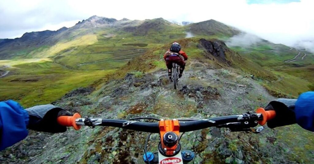
Best Mountain Biking Apps – The Best Apps for mountain biking to track routes, explore new ones, use GPS navigation and share on social networks
Mountain bike apps are now an indispensable tool for two reasons, not necessarily in order of importance: the first is to keep track of our rides , the second to discover new routes to do on the saddle of our MTB.
There are many mountain bike GPS tracking apps that can record the rides we take, and each has its own good reasons for doing so.
There are those who are interested in performance, and then they will need route data as well as physical data, and there are those who just want to keep track of the laps they do, to share them with other people or to retrace them from a time. On the other hand, the second case is different, that of Apps capable of suggesting new paths or which allow you to create your own at the table and then allow you to follow them like a real navigator.
Table of Contents
Best Mountain Biking Apps: Top 12 for Navigation, Tracking, and Sharing
The best thing, in both cases but especially in the second, would be to have a cycle computer, preferably specific for off-road use , with pre-loaded maps and all the necessary functions. But a cycle computer obviously has a different cost than downloading an App on your smartphone and possibly paying for a subscription. And it is precisely the latter that we are going to see in this article.
Strava
The most famous, the most used, at least in its Free version. But Strava is great, maybe the best, when it comes to logging data and then analyzing it . Especially from a performance point of view. If desired, it can also be used for navigation, but only in its paid version (there is the Paths function from a mobile phone ) and it is certainly not among the most popular among MTB enthusiasts .
What many road cyclists do is download GPX tracks and upload them to the Garmin Edge to repeat that particular path. However, a trick that some people use is to use Strava’s Heatmaps to see the trails where riders really go, and go discover them. Not very practical but you can make beautiful discoveries, especially if you are not in your usual area.
Komoot
The rising star of mountain bike apps, pleasant in our country (since October 2019 Komoot has also been available in Italian): there is no Facebook group where the question does not cyclically recur if someone has used Komoot and how is found. What we like is that Komoot is all about exploration rather than competition , and of course about sharing your tracks.
So the more riders there are in an area that use it, the more marked routes there will be. In its Free version it allows you to record your journey and then use it for all the usual social functions. To use it in navigation, therefore being guided along the way, you need the paid version. You don’t pay the subscription but the purchase of the maps, which are divided by regions and which is valid forever.
The interesting thing is that when you register, you have the option of downloading the map of one region for free, while the others can be purchased with various more or less large packages. For those who have an outdoor navigator you can also download the GPX track and load it on your device . Why do it? Because a navigator has a battery that lasts longer, it’s made to stay on a MTB (for example mud, dust and falls that could devastate a smartphone) and because with Komoot there are always new routes traced by new users.
Trailforks
Potentially the best App for mountain biking, since it was created by mountain bikers (PinkBike in North America) for riders, trail builders, groups and even tour associations. In fact, however, although TrailForks is the largest database of trails in the world, it is not widespread in Italy. Both from a desktop and from a smartphone with Trailforks you can discover the descents of an area and how to reach their beginning, from a mobile you can use it for navigation, it allows you to locate yourself and obviously also to create and share new trails.
For the real shooters there are different map views, the paths are marked with different colors based on the difficultyas well as with other information (length, height difference, average gradient) and user comments. The interesting thing is that Trailforks and Strava talk to each other and that, if you want and for the usual reasons, you can download the GPX track and upload it to the Garmin Edge.
Relive
It is not a navigation or data analysis app. But since it allows you to relive your ride in a 3D video, Relive can rightfully be among the Apps for mountain biking. If desired, it can record the track on its own, or it interfaces with other Apps, automatically acquires the track and asks you if you want to create the video with an aerial view of your route . Video that can then be shared on social media. All for free. Maybe for the usual rides around the house you can even postpone it, but when you have an “epic ride” that you want to remember and pass on, it is certainly very captivating and spectacular.
Orux Maps
Little known and little used, perhaps because it’s only for Android, but it’s well done, it’s free (at least the direct download version from the site , not the Google Play version) and it has no advertising. Obviously it allows tracking, for itself and for sharing one’s routes.
But the interesting thing is that it also works in navigation, both online and by downloading the GPX maps to your device (which saves some data and battery, as well as not risking finding yourself without a signal) and that once you have set waypoints you can create your own routes at the table. All exportable in GPX format and loaded on an outdoor navigator. The only problem is that it’s not really easy to use, at least the first few times.
AllTrails
The database of routes, worldwide, is boundless (after all it has been downloaded by over 20 million people all over the world), you can view different types of maps (those of Google, OSM and OpenCycleMaps as well as to the personalized ones of AllTrails ) and in the Free version they can also be downloaded locally.
The best thing is that for practically every route you will find photos, information on the gradient and road surface as well as the comments of other users , so you can see if it is an active and feasible path or if, for example, a rock has fallen or a stone that interrupts it. For all other functions (including downloading the GPX track and uploading it to a cycle computer) you need the paid version
Alpine Quest
The Lite version (that is, free) of Alpine Quest is practically useless (you view the maps, locate yourself with the GPS to know where you are, and little else). In the paid version you can import, create, export tracks and also use it in navigation.
Locus Map
One of the most versatile Apps even in the Free version, although not specialized for MTB. At least as the most hardened riders understand it. If, on the other hand, something is enough for you not to get lost in the woods, Locus Map can be very interesting: the maps can be browsed online or downloaded locally, you can import and export GPX tracks, and obviously you can record the track of your route while you are out and in the saddle.
Viewranger
Among the free ones, from the point of view of geolocation and mapping it is one of the best. It lets you plan, navigate, plot and share your routes, import and export PX files, and there are some nice and useful features, like the compass and the ability to search for tracks in your area and follow them. However, ViewRanger has now joined forces with Outdooractive (see below).
Osmand
In practice they are the OpenStreetMap maps, you can download 7 of them for free (and for MTB that is enough) and there are all the basic functions such as tracking and navigation, even offline and without data consumption (including voice commands). For information: osmand.net
Wikiloc
The Wikiloc site is one of the best known and richest when it comes to sharing outdoor routes, but the App, in the Free version, is only used to record one’s excursion and share it with the community. to download the offline maps or use the App while navigating you need to pay, and it’s a time-based subscription on a monthly or annual basis. If you are a true outdoor lover and practice all or most outdoor disciplines, including horse riding or mountaineering, it can make sense. If you limit yourself to MTB, as we have seen, there are richer alternatives.
Outdooractive
The free version, with advertising, makes OpenStreetMap available worldwide. If you want hiking maps and additional cartography that can also be downloaded offline, you need to activate the PRO or PRO+ version. You can create routes, record your own, share them, you will find a lot of additional information such as the inclination of the slopes or the type of path as well as the possibility of meeting other people or receiving offers. For information: www.outdooractive.com

Pradeep Sharma is a author the mind behind Techjustify, where I craft insightful blogs on technology, digital tools, gaming, AI, and beyond. With years of experience in digital marketing and a passion for tech innovation, I aim to simplify complex topics for readers worldwide.
My mission is to empower individuals with practical knowledge and up-to-date insights, helping them make informed decisions in the ever-evolving digital landscape.